


DON’T ARRIVE AT YOUR DESTINATION. DISCOVER IT.
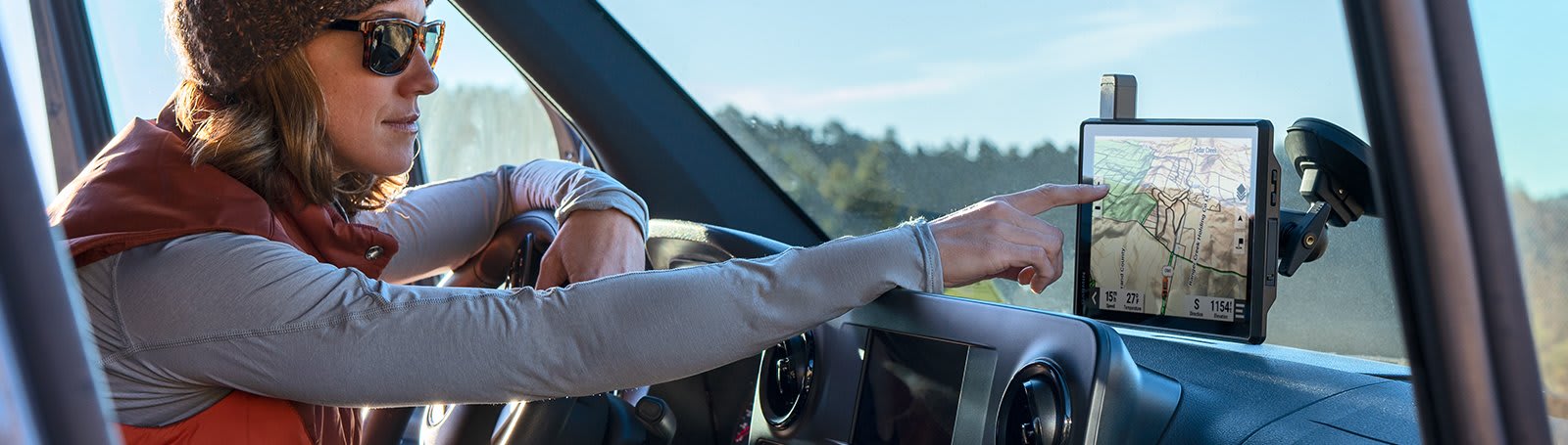
Built for every part of the journey, this extra big, extra rugged all-terrain navigator has the mapping you need to stay on track and communication technology to stay in touch while you’re out there.
![]()
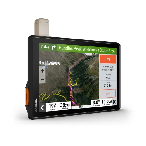
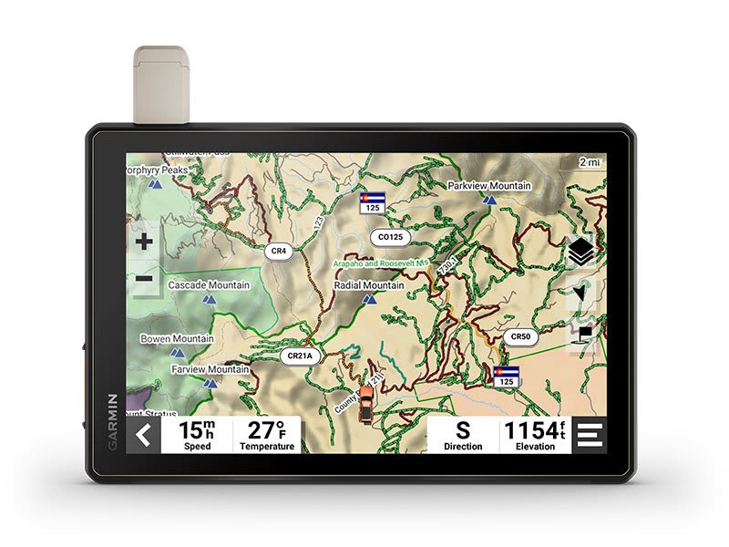
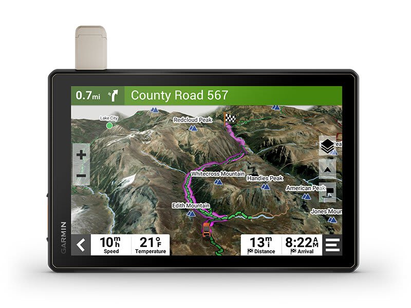
Navigate unpaved roads and trails by using turn-by-turn trail navigation1 with OpenStreetMap (OSM) and USFS Motor Vehicle Use Maps.
![]()
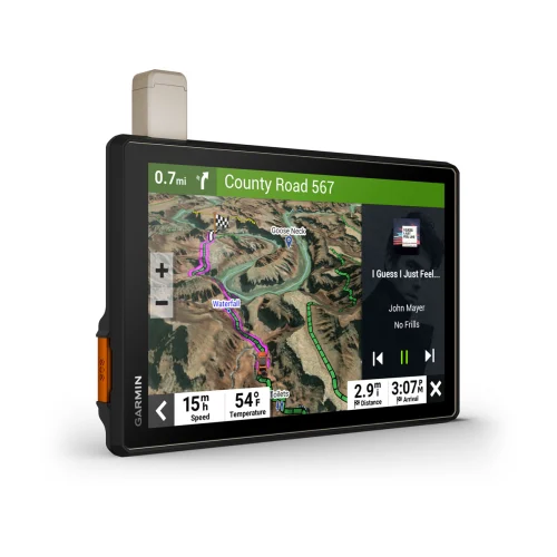
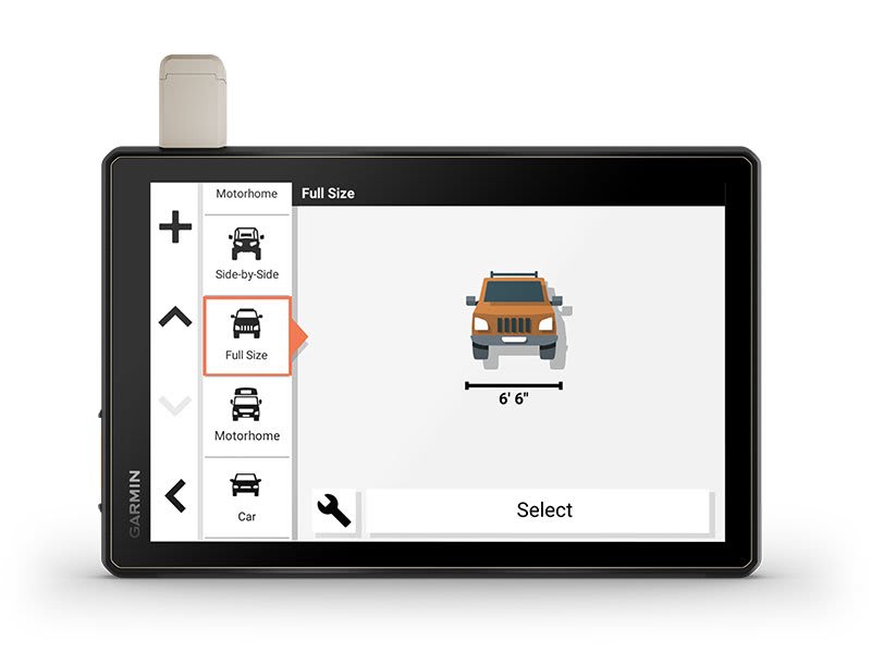
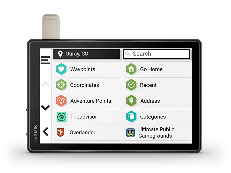
Custom routing for the size and weight of your rig2 and preloaded iOverlander™ points of interest (POIs) help you find where to set up camp.
![]()
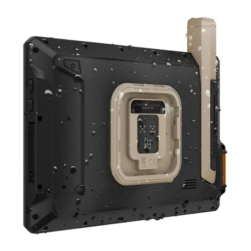
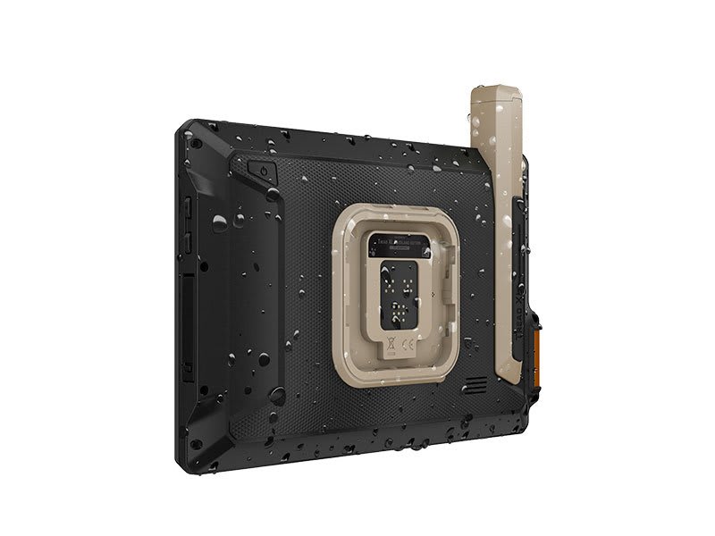
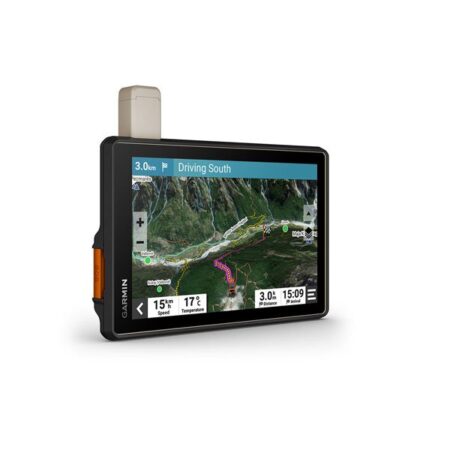
This rugged navigator is IP67 weather-resistant and has an 10” ultrabright touchscreen display.
![]()
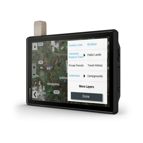
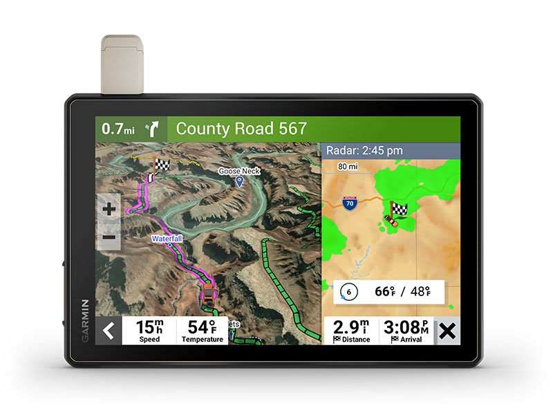
See vivid aerial views of terrain with downloadable, subscription-free BirdsEye Direct Satellite Imagery.
![]()
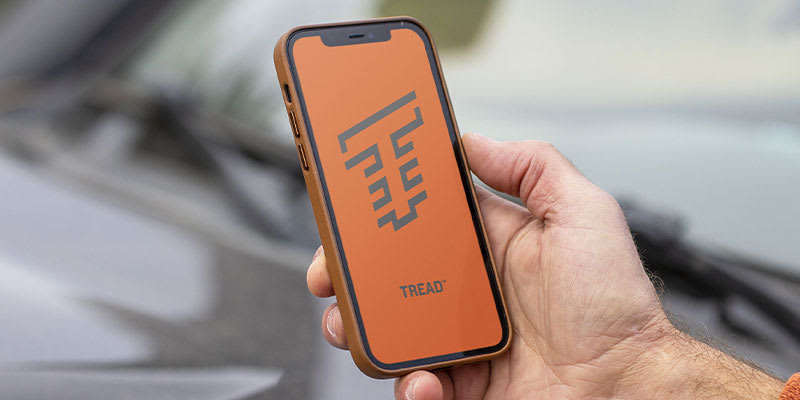
Use the Tread® app on your compatible smartphone to sync data across your various devices and plan routes.
![]()
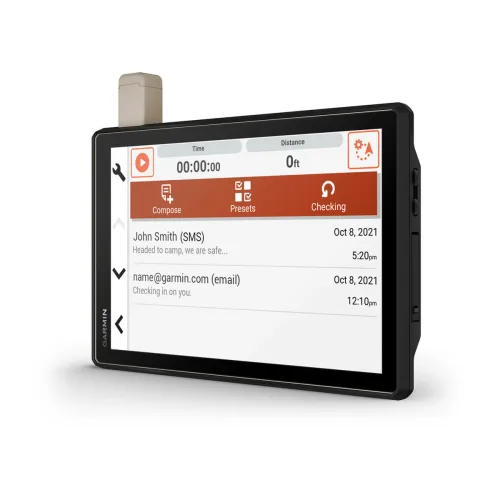
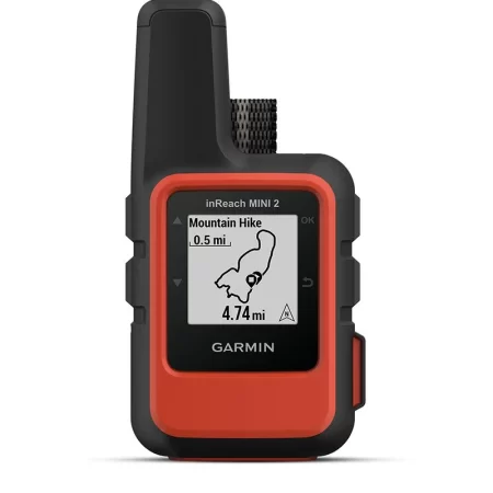
Peace of mind comes built-in. With an active subscription, you can use inReach® technology for global satellite communication.
Built for the journey ahead.
OFF-ROAD RUGGEDNESS
Purpose-built for all-terrain use, this Tread device stands up to anything the elements can throw at it. It’s IP67-rated for water-resistance.
HIGH-VISIBILITY DISPLAY
With its ultrabright 10” glove-friendly touchscreen, the navigator is designed for easy viewing in bright sunlight or pitch dark. It can be mounted in portrait or landscape mode.
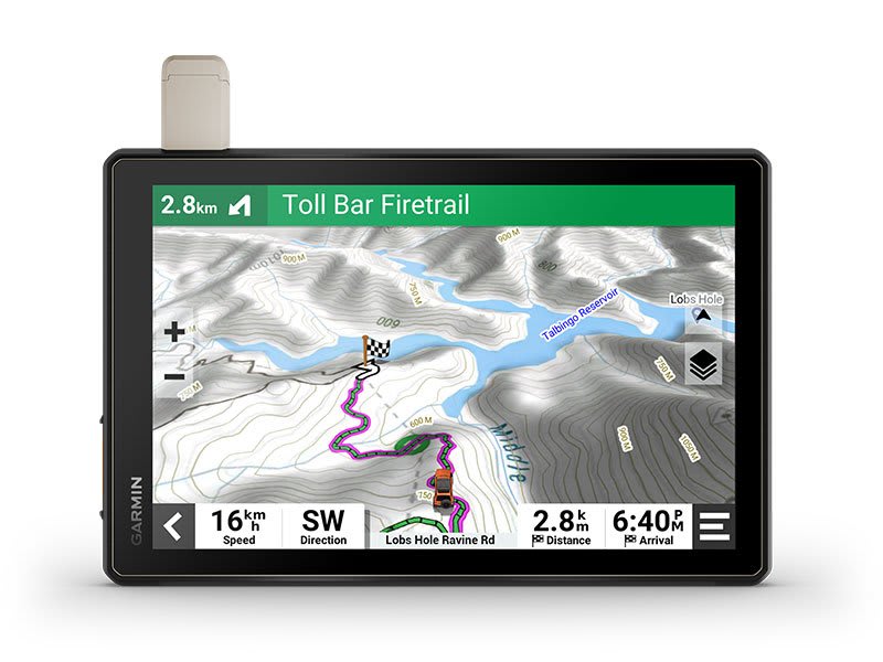
TRAIL NAVIGATION
Enjoy turn-by-turn trail navigation for traversing unpaved roads and trails using adventure roads and trails map content comprised of OSM and USFS Motor Vehicle Use Maps.
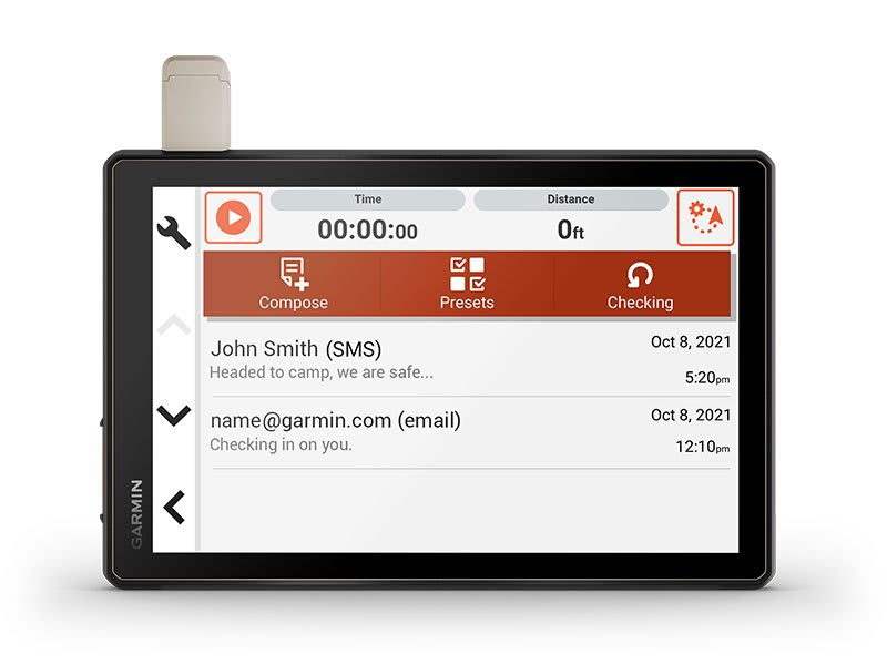
BUILT-IN INREACH TECHNOLOGY
Built-in inReach technology offers global satellite communication3, two-way text messaging, location sharing and interactive SOS (active satellite subscription required).
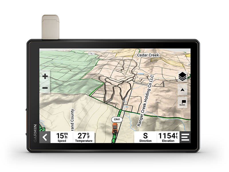
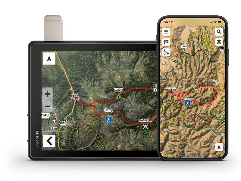
MAPS ON AND OFF-ROAD
Tread includes preloaded topographic maps with 3D terrain for North and South America. It also includes detailed street maps of North America with custom routing for the size and weight of your rig2.
KNOW YOUR BOUNDARIES
Access U.S. public land boundaries for national forests, Bureau of Land Management (BLM), wilderness areas and more. Also, see U.S. private land boundaries and landowner information for parcels greater than 4 acres.
SATELLITE IMAGERY
Enjoy vivid aerial views when you download high-resolution BirdsEye Direct Satellite Imagery directly to your device via Wi-Fi® connectivity, with no annual subscription required.

TRAIL RATINGS
Our growing trail database now includes difficulty ratings for off-road riding areas, where available, across the U.S.
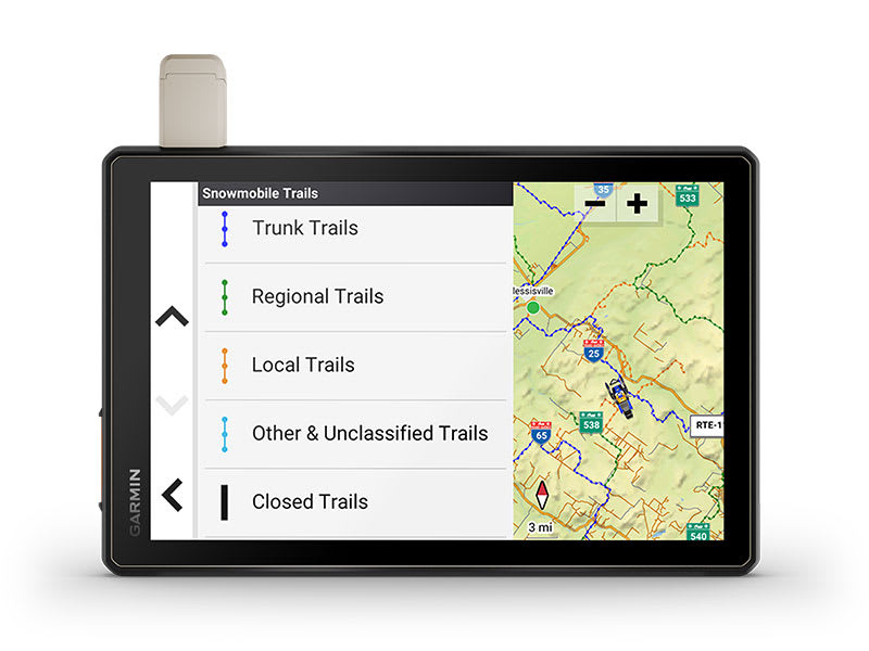
SNOWMOBILE TRAILS
View snowmobile trail content for select areas within the U.S. and in Canadian provinces. This includes snowmobile-accessible locations such as fuel stops, warming shelters, restaurants and more.

OUTDOOR MAPS+
With a paid Outdoor Maps+ subscription, you’ll get ongoing access to a wide variety of additional premium map content. It is regularly updated and delivered directly to your Tread device via Wi-Fi® connectivity.
POINTS OF INTEREST
Tread comes preloaded with iOverlander points of interest and Ultimate Public Campgrounds, so you don’t need a cell signal to route to the best-established, wild and dispersed campsites.
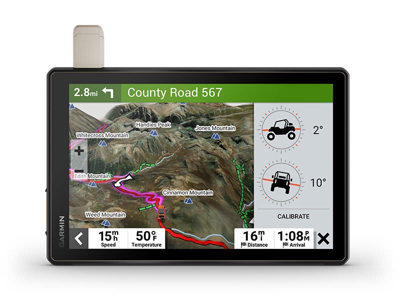
ABC SENSORS
When you’re headed to tough-terrain, the built-in sensors will come in handy — including an altimeter, barometer, compass and pitch/roll gauges.
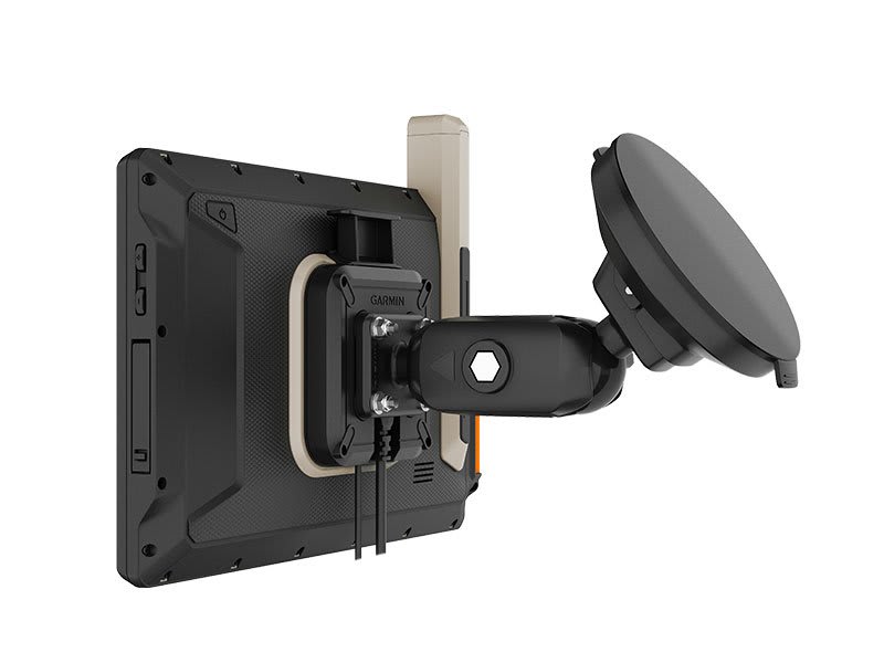
SECURE MOUNT
Use the included locking magnet-assisted mount to secure the navigator to your vehicle.

Connect for a better adventure.
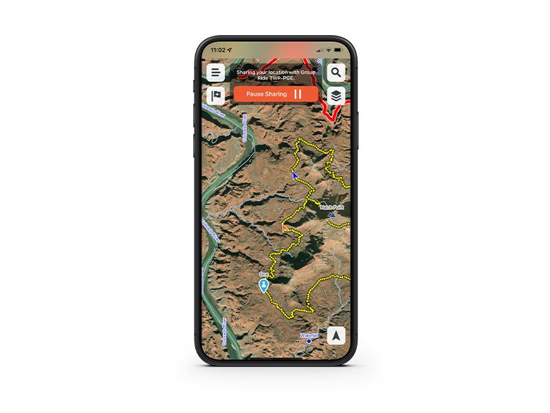
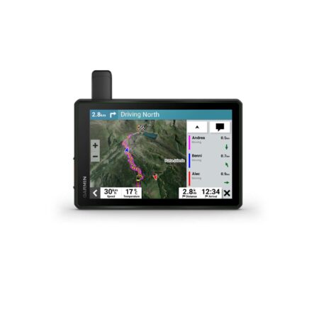
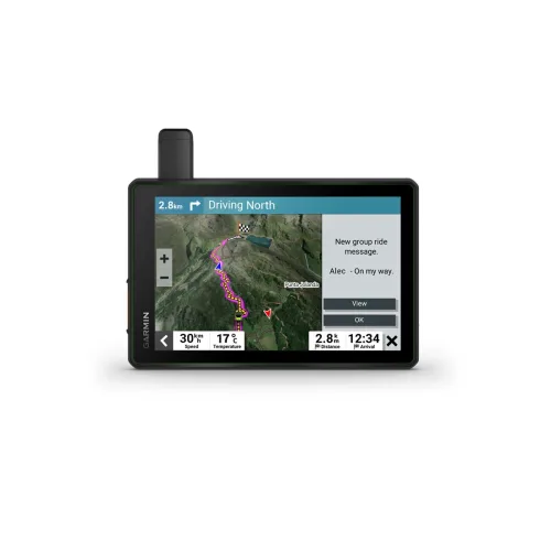
GROUP RIDE MOBILE
Track friends from your compatible smartphone or Tread device when you and your friends use the Tread app’s Group Ride Mobile feature.
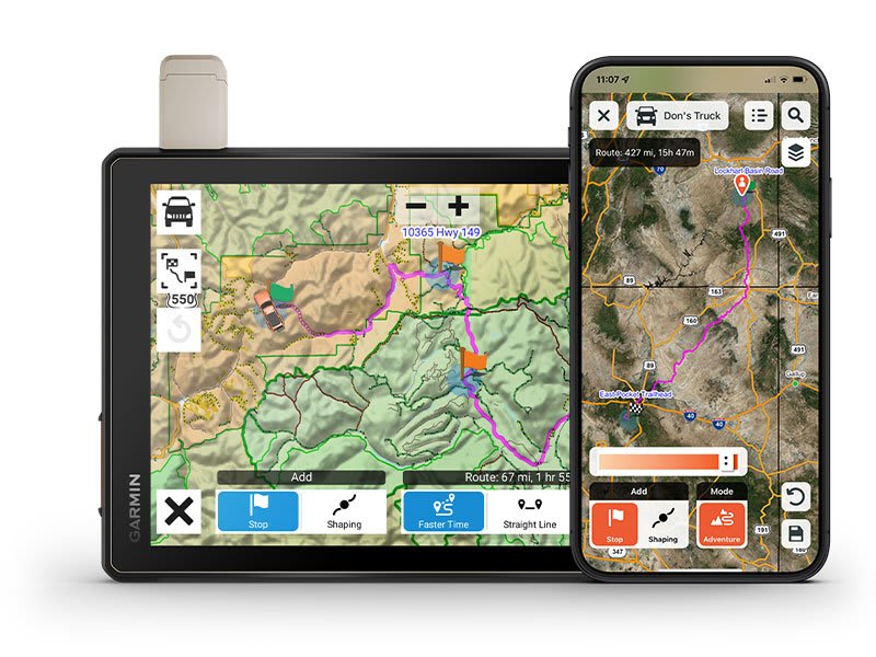
EASY ROUTE PLANNER
Use the Tread app to easily plan routes with the same maps, vehicle profiles and route preferences that you have on the Tread device.
EASILY SYNC YOUR DEVICES
Use the Tread app to sync waypoints, tracks, routes and collections across all your devices. Easily import and share GPX files, too.
LIVE WEATHER
Weather ahead? Pair your Tread device with your compatible smartphone, and download the Tread app to access live weather, storm alerts, animated radar and more.
Overlanding equipment for expeditions.
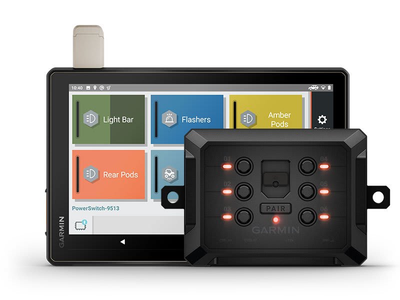
CONTROL YOUR ACCESSORIES
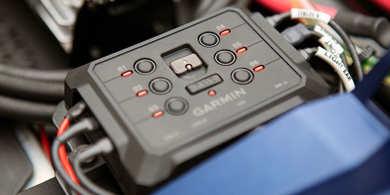
Pair Tread with the compatible Garmin PowerSwitch™ digital switch box (sold separately) to enable on-screen control for your vehicle’s 12-volt electronics — light bars, differential locks and more.
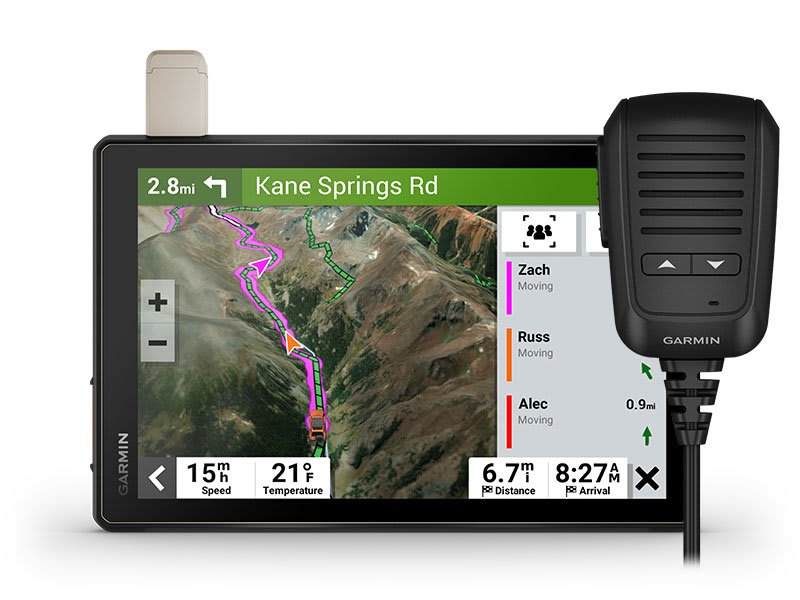
GROUP RIDE RADIO
Pair your device with the compatible Group Ride Radio (sold separately) for communication and tracking of other Tread-equipped riders in your group.
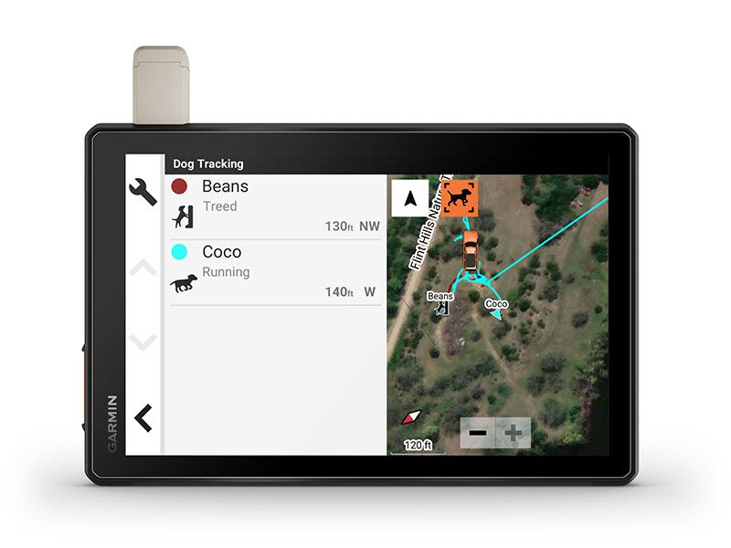
TRACK YOUR DOG PACK
Wirelessly pair Tread with select Garmin GPS dog trackers (sold separately) to help track and retrieve your sporting dogs in the field. You’ll see markers for each dog within tracking range, overlaid right on the navigator’s map screen.
EXPAND YOUR RANGE
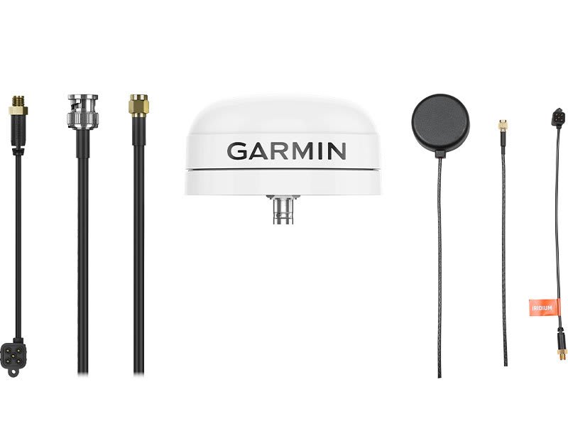
Get enhanced performance with the robust external GPS antenna and external inReach® antenna. Both are in a low-profile, water-resistant housing and have many installation options. Each sold separately.
Control your vehicle’s accessories with Garmin PowerSwitch™
Support your need to wander with off-road maps for every adventure
See what’s behind your vehicle with a Garmin backup camera
Reviews
There are no reviews yet.