
199.000 KD
1 in stock
General |
|
| Dimension | 15.6 x 8.9 x 2.5 (6.15″W x 3.5″H x 1″D) |
|---|---|
| Weight | 340 g (12 oz) |
| Water rating | IPX7 |
| Display Type | Multi-touch, glass, high brightness HD colour TFT with white backlight |
| Display Size | 13.3 x 7.5 (5.3″W x 3″ H); 15.3 cm diag (6″) |
| Display Resolution | 1280 x 720 pixels |
| Dual-Orientation Display | |
| Tube mount (1.5″ – 2.375″) | |
| Handlebar mount (up to 1″) | Yes (smaller tube mount) |
| 1″ ball adapter with AMPS plate | |
| Drop rating | MIL-STD-810 |
| Dust rating | IP6X |
| Battery type | Rechargeable lithium-ion |
| Battery life | Up to 7 hours (up to 5 hours at 100% backlight) |
Maps & memory |
|
| Preloaded street maps | |
|---|---|
| High Definition 3D terrain | |
| Data cards | microSD™ card (not included) |
| 3D Terrain | |
| Internal storage | 64 GB |
| Ability to add maps | |
| Storage and Power Capacity | Yes (256 GB max microSD™ card) |
| Includes map updates | |
| Downloadable Satellite Imagery | |
| TOPO map support | |
Sensors |
|
| GPS | |
|---|---|
| Galileo | |
| Barometric altimeter | |
| Compass | |
| 10 Hz multi-GNSS positioning | |
Outdoor recreation |
|
| Point-to-point navigation | |
|---|---|
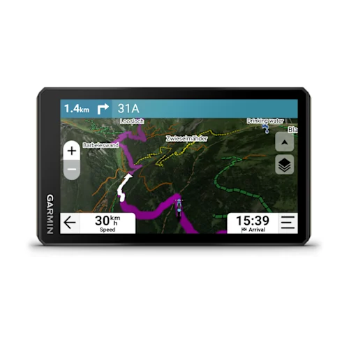
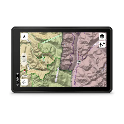
| PRELOADED TOPOGRAPHIC MAPS | |
| Preloaded USFS Roads and Trails, including motor-vehicle-use-maps for motorcycle, ATV, SXS and full-size 4×4 | |
| Navigate-a-track navigation | |
| Turn-by-turn trail navigation | |
| Compatible with Outdoor Maps+ Subscription | |
Camera features |
|
| Backup camera compatible | Yes (BC™ 50 only) |
|---|---|
Navigation features |
|
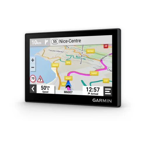
| Garmin Real Directions™ landmark guidance | |
|---|---|
| TripAdvisor® Traveller Ratings | |
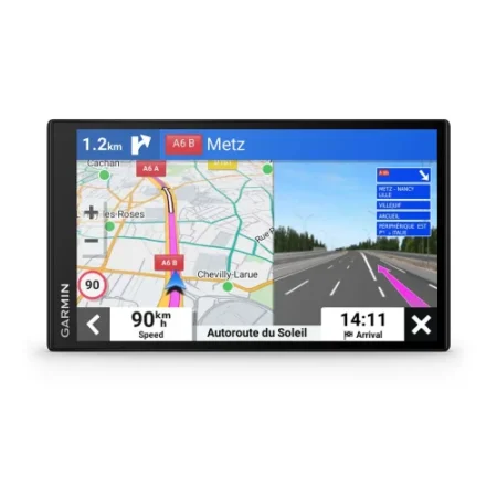
| Route shaping through preferred cities/streets | |
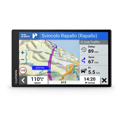
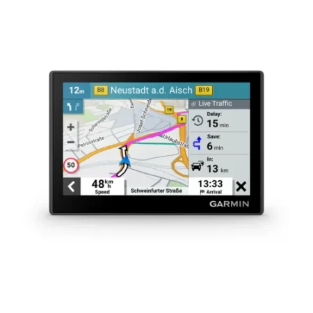
| Traffic Updates | Yes (with Garmin Tread app) |
| Lane assist with junction view (displays junction signs) | |
| Bluetooth® calling | Yes (works with Bluetooth-compatible helmet, headset or smartphone. BLE capable.) |
| Speed limit indicator (displays speed limit for most major roads) | |
Advanced features |
|
| Smart notifications via app | |
|---|---|
| Wi-Fi® map and software updates | |
| Access to live services via app | |
Motorcycle features |
|
| Control music and media from smartphone or MP3 player | |
|---|---|
| Sunlight readable and weather resistant | |
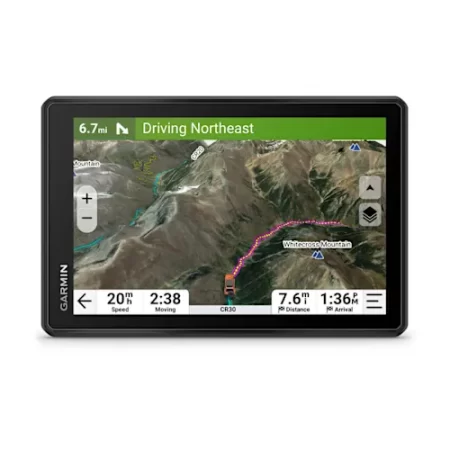
| GARMIN ADVENTUROUS ROUTING™ | |
| Elevation profile | |
| Round trip routing | |
| Custom map support | |
| Wireless ANT+® technology | |
Camper Features |
|
| Specialised routing for the size and weight of your vehicle | |
|---|---|
| Speed limit changes | |
| Easy Route Planner with GPX file sharing | |
Adventure features |
|
| Pair with compatible inReach® devices | |
|---|---|
| Pair with Garmin PowerSwitch™ digital switch box | |
| Compatible with handlebar controller | |
| Compatible with Group Ride Tracker (6”, 8” and 10”) | |
| Group Ride Mobile | Yes (with Garmin Tread app) |
| Track recorder (breadcrumbs) | |
| Compatible with the Garmin Tread app for route planning and data management (waypoints, tracks, and routes) | |
| ACSI, Campercontact and Trailer’s PARK | |
| Pitch and roll gauges | |
| Birdseye Satellite Imagery (download via Wi-Fi) | |
| Glove-friendly touchscreen | |
Outdoor applications |
|
| Dog tracking | |
|---|---|
Security Information |
|
| Security updates until at least (YYYY-MM-DD) | 2026-11-05 |
|---|---|
Reviews
There are no reviews yet.